Mohegan-Pequot Bridge
| Mohegan-Pequot Bridge | |
|---|---|
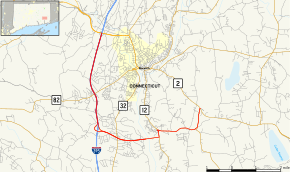 Map of CT 2A | |
| Coordinates | 41°28′54″N 72°04′29″W / 41.4818°N 72.0748°WCoordinates: 41°28′54″N 72°04′29″W / 41.4818°N 72.0748°W |
| Carries |
|
| Crosses | Thames River |
| Named for | Native American tribes of the local area |
| Owner | CT DOT |
| Characteristics | |
| Total length | 1435 feet |
| Width | 2 lanes |
| Height | 75 feet |
| History | |
| Construction cost | $7.5 million |
| Opened | December 1, 1967 |
| Rebuilt | 1996 |
| Statistics | |
| Toll | 1967-1976: 15¢. 1976-1980: 25¢. Currently: None |
The Mohegan-Pequot Bridge is a bridge in Montville and Preston, Connecticut. It carries Connecticut Route 2A (Route 2A) over the Thames River. It is a standard highway bridge, found most where else. It was built in 1967 with tolls, which were removed in 1980. It is the northernmost crossing of the Thames River.[1]
References
- ↑ Oglesby, Scott. "Connecticut Route 2A". www.kurumi.com. Retrieved 2016-08-04.
This article is issued from Wikipedia - version of the 9/29/2016. The text is available under the Creative Commons Attribution/Share Alike but additional terms may apply for the media files.