Mont-Saint-Guibert
| Mont-Saint-Guibert | |||
|---|---|---|---|
| Municipality | |||
|
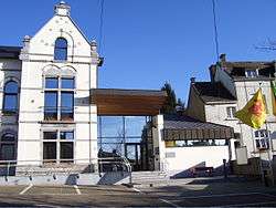
Mont-Saint-Guibert town hall | |||
| |||
 Mont-Saint-Guibert Location in Belgium | |||
|
The municipality of Mont-Saint-Guibert in Walloon Brabant 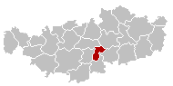 | |||
| Coordinates: 50°38′N 04°37′E / 50.633°N 4.617°ECoordinates: 50°38′N 04°37′E / 50.633°N 4.617°E | |||
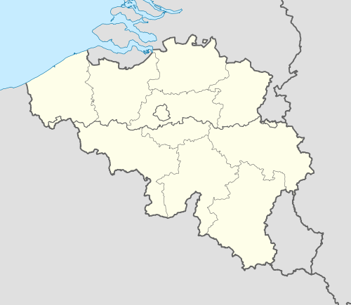
| Country | Belgium | ||
| Community | French Community | ||
| Region | Wallonia | ||
| Province | Walloon Brabant | ||
| Arrondissement | Nivelles | ||
| Government | |||
| • Mayor | Philippe Evrard | ||
| • Governing party/ies | Ecolo - UC | ||
| Area | |||
| • Total | 18.63 km2 (7.19 sq mi) | ||
| Population (1 January 2016)[1] | |||
| • Total | 7,364 | ||
| • Density | 400/km2 (1,000/sq mi) | ||
| Postal codes | 1435 | ||
| Area codes | 010 | ||
| Website | www.mont-saint-guibert.be | ||

Mont-Saint-Guibert is a Walloon municipality (commune in French, like an American county) located in the Belgian province of Walloon Brabant. On January 1, 2012, Mont-Saint-Guibert had a total population of 7000. The total area is 18.63 km² which gives a population density of 344 inhabitants per km².
In addition to Mont-Saint-Guibert itself, the municipality includes the villages of Corbais and Hévillers.
References
- ↑ Population per municipality as of 1 January 2016 (XLS; 397 KB)
External links
-
 Media related to Mont-Saint-Guibert at Wikimedia Commons
 - Municipality of Mont-Saint-Guibert
 |
Ottignies-Louvain-la-Neuve | Chaumont-Gistoux | | |
| Court-Saint-Étienne | |
Walhain | ||
| ||||
| | ||||
| Chastre |
This article is issued from Wikipedia - version of the 12/1/2016. The text is available under the Creative Commons Attribution/Share Alike but additional terms may apply for the media files.