Mount Bangeta
| Mount Bangeta | |
|---|---|
| Mount Sarawaget | |
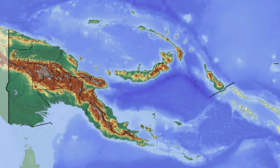 Mount Bangeta Location in Papua New Guinea | |
| Highest point | |
| Elevation | 4,121 m (13,520 ft) [1] |
| Prominence | 1,701 m (5,581 ft) [1] |
| Listing | Ultra |
| Coordinates | 6°18′39″S 147°05′24″E / 6.31083°S 147.09000°ECoordinates: 6°18′39″S 147°05′24″E / 6.31083°S 147.09000°E [1] |
| Geography | |
| Location | Morobe Province, Papua New Guinea |
| Parent range | Saruwaged Range |
Mount Bangeta, also known as Mount Sarawaget, is the highest mountain in Morobe Province, Papua New Guinea. It lies in the Saruwaged Range and at 4,121 m (13,520 ft) it is one of the highest mountains in the country.
See also
References
- 1 2 3 "Papua New Guinea Ultra-Prominence Page" Peaklist.org. Listed as "Mt. Sarawaget". Retrieved 2011-11-19.
External links
- "Mount Bangeta". Peakbagger.com.
Highest Mountains of Papua New Guinea | ||
|---|---|---|
| ||
This article is issued from Wikipedia - version of the 3/2/2013. The text is available under the Creative Commons Attribution/Share Alike but additional terms may apply for the media files.