Mount Fitzgerald (Nevada)
For other uses, see Mount Fitzgerald (disambiguation).
| Mount Fitzgerald | |
|---|---|
 | |
| Highest point | |
| Elevation | 11,220 ft (3,420 m) NAVD 88[1] |
| Prominence | 615 ft (187 m) [1] |
| Coordinates | 40°36′20″N 115°24′38″W / 40.6054829°N 115.4106096°WCoordinates: 40°36′20″N 115°24′38″W / 40.6054829°N 115.4106096°W [2] |
| Geography | |
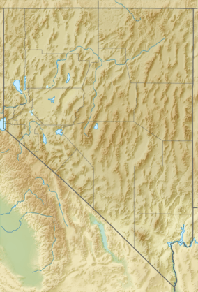 Mount Fitzgerald Location in Nevada | |
| Location | Elko County, Nevada, U.S. |
| Parent range | Ruby Mountains |
| Topo map | USGS Ruby Dome |
| Climbing | |
| Easiest route | East Side from Snow Lake: Hike & Scramble |
Mount Fitzgerald is the fourth-highest named mountain in the Ruby Mountains and the fifth-highest in Elko County, in Nevada, United States. It is the thirty-ninth-highest mountain in the state.[3] It rises from the heads of both Thomas and Right Fork Canyons (branches of Lamoille Canyon), and is also part of the north wall of Box Canyon, making it a true glacial horn. The summit is a high-level ridge and is located about 24 miles (39 km) southeast of the community of Elko, within the Ruby Mountains Wilderness of the Ruby Mountains Ranger District in the Humboldt-Toiyabe National Forest.
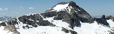
Mount Fitzgerald, Nevada, looking southwest.
References
- 1 2 "Mount Fitzgerald, Nevada". Peakbagger.com. Retrieved 2011-05-15.
- ↑ "Mount Fitzgerald". Geographic Names Information System. United States Geological Survey. Retrieved 2008-11-21.
- ↑ "Nevada 11,000-foot Peaks". Peakbagger.com. Retrieved 2014-10-22.
| Wikimedia Commons has media related to Mount Fitzgerald (Nevada). |
This article is issued from Wikipedia - version of the 10/25/2016. The text is available under the Creative Commons Attribution/Share Alike but additional terms may apply for the media files.