Mount Skook Davidson
| Mount Skook Davidson | |
|---|---|
 Mount Skook Davidson | |
| Highest point | |
| Elevation | 2,382 m (7,815 ft) [1] |
| Prominence | 1,361 m (4,465 ft) [1] |
| Coordinates | 58°40′54″N 127°19′57″W / 58.68167°N 127.33250°WCoordinates: 58°40′54″N 127°19′57″W / 58.68167°N 127.33250°W [2] |
| Geography | |
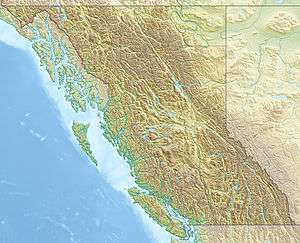
| Location | British Columbia, Canada |
| Parent range | Kechika Ranges |
| Topo map | 94L/11 |
Mount Skook Davidson, 2,382 metres (7,815 ft),[1] is a mountain in the Kechika Ranges of the Cassiar Mountains in far northern British Columbia, Canada. It overlooks the Flying J Ranch, which was founded by John Ogilvie Davidson, known as "Skook" Davidson or "Skookum" Davidson because of his stature (big and strong, see skookum). Davidson was a notable local pioneer who worked as a land surveyor before taking up packing and guiding and ranching in this area.[3] He helped discover and select the route for the Alaska Highway.[4]
See also
Prominence
Its topographic prominence is 1361m above its col at Denetiah Lake.[1]
References
- 1 2 3 4 "Mount Skook Davidson". Bivouac.com. Retrieved 2013-04-28.
- ↑ "Mount Skook Davidson". BC Geographical Names. Retrieved 2013-04-28.
- ↑ "Skooks Landing". BC Geographical Names. Retrieved 2013-04-28.
- ↑ The Newspapering Murrays, Georgina Keddell
This article is issued from Wikipedia - version of the 1/11/2014. The text is available under the Creative Commons Attribution/Share Alike but additional terms may apply for the media files.