Mount Tokachiporoshiri
| Mount Tokachiporshiri | |
|---|---|
| 十勝幌尻岳 | |
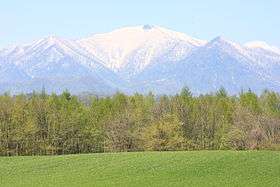 A view from Nakasatsunai Village | |
| Highest point | |
| Elevation | 1,846.0 m (6,056.4 ft) |
| Listing | List of mountains and hills of Japan by height |
| Coordinates | 42°41′44″N 142°51′34″E / 42.69556°N 142.85944°ECoordinates: 42°41′44″N 142°51′34″E / 42.69556°N 142.85944°E |
| Geography | |
| Location | Hokkaidō, Japan |
| Parent range | Hidaka Mountains |
| Topo map | Geographical Survey Institute (国土地理院 Kokudochiriin) 25000:1 札内岳, 50000:1 札内岳 |
| Geology | |
| Mountain type | Fold |
Mount Tokachiporoshiri (十勝幌尻岳 Tokachiporoshiri-dake) is located in the Hidaka Mountains, Hokkaidō, Japan.
References
- Shyun Umezawa, Yasuhiko Sugawara, and Jun Nakagawa, Hokkaidō Natsuyama Gaido 4: Hidaka Sanmyaku no Yamayama (北海道夏山ガイド4日高山脈の山やま), Sapporo, Hokkaidō Shimbunshya, 1991. ISBN 4-89363-605-7
This article is issued from Wikipedia - version of the 11/1/2013. The text is available under the Creative Commons Attribution/Share Alike but additional terms may apply for the media files.