North Dakota Highway 3
"ND 3" redirects here. ND 3 may also refer to North Dakota's 3rd congressional district.
| ||||
|---|---|---|---|---|
| Route information | ||||
| Maintained by NDDOT | ||||
| Length: | 247.530 mi[1] (398.361 km) | |||
| Existed: | 1939 – present | |||
| Major junctions | ||||
| South end: |
| |||
| North end: |
| |||
| Highway system | ||||
| ||||
.svg.png)
North Dakota Highway 3 is a major north–south highway in North Dakota. It runs from Manitoba Highway 10 at the International Peace Garden to South Dakota Highway 45 south of Ashley.
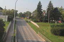
North Dakota 3 in Rugby
Major intersections
| County | Location | mi[1] | km | Destinations | Notes |
|---|---|---|---|---|---|
| McPherson | Central McPherson Unorganized Territory | 0.000 | 0.000 | Continuation into South Dakota | |
| McIntosh | Ashley | 6.810 | 10.960 | Eastern end of ND 11 concurrency | |
| Southwest McIntosh Unorganized Territory | 15.193 | 24.451 | Western end of ND 11 concurrency | ||
| Wishek | 31.974 | 51.457 | Eastern end of ND 13 concurrency | ||
| Northwest McIntosh Unorganized Territory | 41.862 | 67.370 | Western end of ND 13 concurrency | ||
| Logan | Napoleon | 59.566 | 95.862 | ||
| Kidder | Sibley Township | 85.111 | 136.973 | Eastern end of I-94 concurrency; exit 208 | |
| Sibley–Woodlawn township line | Robinson | Exit 205 | |||
| Woodlawn Township | 93.053 | 149.754 | Western end of I-94 concurrency; exit 200 | ||
| Clear Lake Township | 113.232 | 182.229 | |||
| Wells | Bull Moose Township | 134.277 | 216.098 | Western end of ND 200 concurrency | |
| Hurdsfield | 136.278 | 219.318 | Eastern end of ND 200 concurrency | ||
| Forward Township | 157.366 | 253.256 | Southern end of US 52 concurrency; southern terminus of US 52 Bus. | ||
| Hillsdale Township | 159.341 | 256.434 | Northern end of US 52 concurrency | ||
| 159.630 | 256.900 | ||||
| 160 | 260 | Short Spur to US 52 | |||
| Pierce | South Pierce Unorganized Territory | 177.190 | 285.160 | ||
| Rugby | 201.386 | 324.099 | |||
| North Pierce Unorganized Territory | 212.311 | 341.681 | Western terminus of ND 17; southern terminus of ND 60 | ||
| Rolette | Kohlmeier Township | 224.336 | 361.034 | Western terminus of ND 66 | |
| Dunseith | 233.548 | 375.859 | Eastern end of ND 5 concurrency; southern end of US 281 concurrency | ||
| 233.987 | 376.566 | Western end of ND 5 concurrency | |||
| North Rolette Unorganized Territory | 244.140 | 392.905 | Eastern terminus of ND 43 | ||
| Division No. 5 | | 247.530 | 398.361 | Continuation into Manitoba; northern end of US 281 concurrency | |
1.000 mi = 1.609 km; 1.000 km = 0.621 mi
| |||||
References
- 1 2 North Dakota Department of Transportation (2015). Route and Mileage Map (PDF) (Map). Bismarck: North Dakota Department of Transportation. Retrieved July 22, 2016.
- Geelhart, Chris. "Highways 1 to 30". The North Dakota Highways Page. Retrieved 2007-04-29.
This article is issued from Wikipedia - version of the 12/4/2016. The text is available under the Creative Commons Attribution/Share Alike but additional terms may apply for the media files.