Niederhollabrunn
| Niederhollabrunn | ||
|---|---|---|
 | ||
| ||
 Niederhollabrunn Location within Austria | ||
| Coordinates: 48°27′N 16°18′E / 48.450°N 16.300°ECoordinates: 48°27′N 16°18′E / 48.450°N 16.300°E | ||
| Country | Austria | |
| State | Lower Austria | |
| District | Korneuburg | |
| Government | ||
| • Mayor | Franz Zinnerer | |
| Area | ||
| • Total | 50.36 km2 (19.44 sq mi) | |
| Elevation | 242 m (794 ft) | |
| Population (1 January 2016)[1] | ||
| • Total | 1,528 | |
| • Density | 30/km2 (79/sq mi) | |
| Time zone | CET (UTC+1) | |
| • Summer (DST) | CEST (UTC+2) | |
| Postal code | 2004 | |
| Area code | 02269 | |

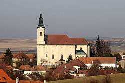
Niederhollabrunn is a town in the district of Korneuburg in the Austrian state of Lower Austria.
Population
| Historical population | ||
|---|---|---|
| Year | Pop. | ±% |
| 1869 | 2,111 | — |
| 1880 | 2,256 | +6.9% |
| 1890 | 2,420 | +7.3% |
| 1900 | 2,206 | −8.8% |
| 1910 | 2,312 | +4.8% |
| 1923 | 2,349 | +1.6% |
| 1934 | 2,117 | −9.9% |
| 1939 | 2,063 | −2.6% |
| 1951 | 1,810 | −12.3% |
| 1961 | 1,543 | −14.8% |
| 1971 | 1,337 | −13.4% |
| 1981 | 1,289 | −3.6% |
| 1991 | 1,323 | +2.6% |
| 2001 | 1,495 | +13.0% |
| 2011 | 1,591 | +6.4% |
References
This article is issued from Wikipedia - version of the 11/26/2013. The text is available under the Creative Commons Attribution/Share Alike but additional terms may apply for the media files.