Norristown, Georgia
| Norristown, Georgia | |
|---|---|
| Census-designated place | |
 Norristown | |
| Coordinates: 32°30′25″N 82°29′39″W / 32.50694°N 82.49417°WCoordinates: 32°30′25″N 82°29′39″W / 32.50694°N 82.49417°W | |
| Country | United States |
| State | Georgia |
| County | Emanuel |
| Area[1] | |
| • Total | 0.411 sq mi (1.06 km2) |
| • Land | 0.405 sq mi (1.05 km2) |
| • Water | 0.006 sq mi (0.02 km2) |
| Elevation | 246 ft (75 m) |
| Population (2010) | |
| • Total | 59 |
| • Density | 140/sq mi (55/km2) |
| Time zone | Eastern (EST) (UTC-5) |
| • Summer (DST) | EDT (UTC-4) |
| ZIP code | 30447 |
| Area code(s) | 478 |
| GNIS feature ID | 332511[2] |
Norristown is a census-designated place and unincorporated community in Emanuel County, Georgia, United States. Its population was 59 as of the 2010 census.[1] Norristown has a post office with ZIP code 30447, which opened on May 8, 1878.[3][4] U.S. Route 221 passes through the community.
References
- 1 2 "2010 Census Gazetteer Files - Places: Georgia". U.S. Census Bureau. Retrieved January 4, 2015.
- ↑ "Norristown". Geographic Names Information System. United States Geological Survey.
- ↑ United States Postal Service. "USPS - Look Up a ZIP Code". Retrieved January 4, 2015.
- ↑ "Postmaster Finder - Post Offices by ZIP Code". United States Postal Service. Retrieved January 4, 2015.
Municipalities and communities of Emanuel County, Georgia, United States | ||
|---|---|---|
| Cities | 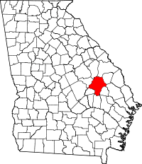 | |
| CDPs | ||
| Footnotes | ‡This populated place also has portions in an adjacent county or counties | |
This article is issued from Wikipedia - version of the 6/7/2016. The text is available under the Creative Commons Attribution/Share Alike but additional terms may apply for the media files.