Northfork Township, Barton County, Missouri
| Northfork Township | |
|---|---|
| Township | |
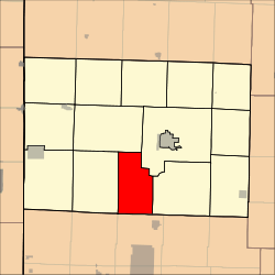 Location in Barton County | |
| Coordinates: 37°23′08″N 094°20′21″W / 37.38556°N 94.33917°WCoordinates: 37°23′08″N 094°20′21″W / 37.38556°N 94.33917°W | |
| Country | United States |
| State | Missouri |
| County | Barton |
| Area | |
| • Total | 33.05 sq mi (85.6 km2) |
| • Land | 32.92 sq mi (85.27 km2) |
| • Water | 0.13 sq mi (0.33 km2) 0.39% |
| Elevation | 935 ft (285 m) |
| Population (2000) | |
| • Total | 256 |
| • Density | 7.8/sq mi (3/km2) |
| GNIS feature ID | 0766284 |
Northfork Township is a township in Barton County, Missouri, USA. As of the 2000 census, its population was 256.
The township takes its name from the North Fork of the Spring River.[1]
Geography
Northfork Township covers an area of 33.05 square miles (85.6 km2) and contains no incorporated settlements. According to the USGS, it contains three cemeteries: Killey, Oak Grove and Waters.
References
- ↑ "Barton County Place Names, 1928-1945 (archived)". The State Historical Society of Missouri. Retrieved 31 August 2016.
External links
Municipalities and communities of Barton County, Missouri, United States | ||
|---|---|---|
| Cities | 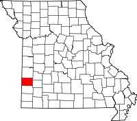 | |
| Villages | ||
| Townships | ||
| CDP | ||
| Other unincorporated communities | ||
| Ghost towns | ||
This article is issued from Wikipedia - version of the 9/3/2016. The text is available under the Creative Commons Attribution/Share Alike but additional terms may apply for the media files.