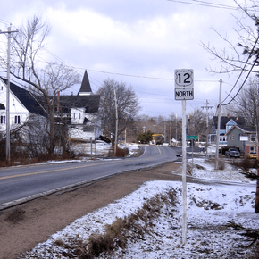
Nova Scotia Trunk 12
| ||||
|---|---|---|---|---|
 | ||||
| Route information | ||||
| Length: | 67 km (42 mi) | |||
| Major junctions | ||||
| North end: |
| |||
|
| ||||
| South end: |
| |||
| Location | ||||
| Counties: | Lunenburg, Kings | |||
| Towns: | Kentville | |||
| Highway system | ||||
|
Provincial highways in Nova Scotia
| ||||

Trunk 12 is part of the Canadian province of Nova Scotia's system of Trunk Highways. The route runs from Chester Basin to Kentville, a distance of 67 kilometres.
The road's routing is through mostly uninhabited forest land, with a few small villages such as New Ross located on the route. For about 5 km, the road follows the eastern shore of Gaspereau Lake, the largest lake in Kings County, Nova Scotia.
Communities
| Preceded by |
Trunk 12 Nova Scotia |
Succeeded by |
External links
References
This article is issued from Wikipedia - version of the 7/12/2016. The text is available under the Creative Commons Attribution/Share Alike but additional terms may apply for the media files.