Ohtamış
| Ohtamış | |
|---|---|
| Town | |
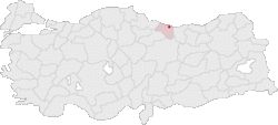 Location of Ohtamış within Turkey. | |
| Coordinates: 40°52′N 37°44′E / 40.867°N 37.733°ECoordinates: 40°52′N 37°44′E / 40.867°N 37.733°E | |
| Country |
|
| Region | Black Sea |
| Province | Ordu Province |
| Elevation | 602 m (1,975 ft) |
| Population | |
| • Total | 1,570 |
| Time zone | EET (UTC+2) |
| • Summer (DST) | EEST (UTC+3) |
| Postal code | 52 |
| Area code(s) | 0452 |
| Licence plate | 52 |
Ohtamış is a village in the Ulubey district of Ordu Province, Turkey. The village is approximately 21 km south of the Black Sea. The village had a population of 1,570 as of 2000.[1]
References
- ↑ "Ohtamış Köyü". Local Government Research and Training Centre of The Public Administration Institute for Turkey and the Middle East. Retrieved 2008-06-05. (Turkish)
This article is issued from Wikipedia - version of the 12/23/2014. The text is available under the Creative Commons Attribution/Share Alike but additional terms may apply for the media files.