Puerto Rico Highway 18
| ||||
|---|---|---|---|---|
|
Expreso Las Américas | ||||
 | ||||
| Route information | ||||
| Maintained by Puerto Rico Dept. of Transportation and Public Works (DTOP) | ||||
| Existed: | 1960's and rebuilt in late 90's – present | |||
| Major junctions | ||||
| North end: |
| |||
| PR-52 | ||||
| South end: |
| |||
| Highway system | ||||
| ||||

PR-18 is a freeway in Puerto Rico, which is also known as Expreso Las Américas. It runs from its north end in at its intersection with PR-22 (known as Expreso de Diego) in San Juan to its south end in Río Piedras where it intersects with PR-1. At this point PR-18 becomes PR-52, known as Autopista Luis A. Ferré.
Route description
PR-18 begins from PR-22
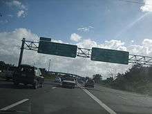
PR-18 connects PR-52 to PR-22 and intersects with PR-17 (Ave. Piñero), PR-23 (Ave. Roosevelt), which grants access to Plaza Las Américas, and Ave. Domenech. It is mostly a 4-lane road in each direction. The combined route of PR-18 and PR-52 is coterminous with the unsigned Interstate Highway PRI-1.
Major intersections
| Municipality | Location | km | mi | Exit | Destinations | Notes |
|---|---|---|---|---|---|---|
| San Juan | 0.0 | 0.0 | South end of PR-18; PRI-1 continues southbound via PR-52 | |||
| Avenida Americo Miranda | ||||||
| Calle Ing Manuel Domenech | ||||||
| 3A | ||||||
| Calle Carlos F. Chardón | ||||||
| North end of PR-18 and PRI-1 | ||||||
| 1.000 mi = 1.609 km; 1.000 km = 0.621 mi | ||||||
See also
| Signed | |||||||||||
|---|---|---|---|---|---|---|---|---|---|---|---|
| Unsigned | |||||||||||
| Lists |
| ||||||||||
Major Interstates highlighted | |||||||||||
This article is issued from Wikipedia - version of the 8/20/2016. The text is available under the Creative Commons Attribution/Share Alike but additional terms may apply for the media files.