Palterndorf-Dobermannsdorf
| Palterndorf-Dobermannsdorf | ||
|---|---|---|
 | ||
| ||
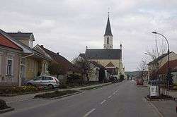
 Palterndorf-Dobermannsdorf Location within Austria | ||
| Coordinates: 48°34′N 16°49′E / 48.567°N 16.817°ECoordinates: 48°34′N 16°49′E / 48.567°N 16.817°E | ||
| Country | Austria | |
| State | Lower Austria | |
| District | Gänserndorf | |
| Government | ||
| • Mayor | Herbert Nowohradsky | |
| Area | ||
| • Total | 18.64 km2 (7.20 sq mi) | |
| Elevation | 164 m (538 ft) | |
| Population (1 January 2016)[1] | ||
| • Total | 1,293 | |
| • Density | 69/km2 (180/sq mi) | |
| Time zone | CET (UTC+1) | |
| • Summer (DST) | CEST (UTC+2) | |
| Postal code | 2462 | |
| Area code | 02533 | |
| Website | www.palterndorf.at | |

Palterndorf-Dobermannsdorf is a town in the district of Gänserndorf in the Austrian state of Lower Austria.
Geography
Palterndorf-Dobermannsdorf lies in the hills of the eastern Weinviertel on the historic Bernsteinstraße in the valley of the Zaya River. Only about 2.2 of the municipality is forested.
References
- ↑ Statistik Austria - Bevölkerung zu Jahresbeginn 2002-2016 nach Gemeinden (Gebietsstand 1.1.2016) for Palterndorf-Dobermannsdorf.
This article is issued from Wikipedia - version of the 6/17/2016. The text is available under the Creative Commons Attribution/Share Alike but additional terms may apply for the media files.