Paung
| Paung ပေါင်မြို့ | |
|---|---|
 Paung Location in Burma | |
| Coordinates: 16°37′22″N 97°27′37″E / 16.62278°N 97.46028°ECoordinates: 16°37′22″N 97°27′37″E / 16.62278°N 97.46028°E | |
| Country |
|
| Division | Mon State |
| District | Thaton District |
| Township | Paung Township |
| Population (2005) | |
| • Religions | Buddhism |
| Time zone | MST (UTC+6.30) |
Paung (Burmese: ပေါင်မြို့; Mon: ပံင်, [pɔŋ]) is a town in the Mon State of south-east Myanmar.
External links
Capital: Mawlamyine | ||
| Mawlamyine District | 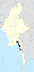 | |
| Thaton District | ||
| Cities and towns | ||
This article is issued from Wikipedia - version of the 2/13/2016. The text is available under the Creative Commons Attribution/Share Alike but additional terms may apply for the media files.