Poloni
For the surname, see Poloni (surname).
| Poloni | |
|---|---|
| Municipality | |
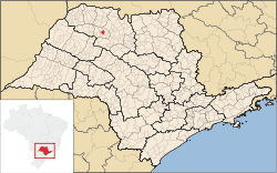 Location in São Paulo state | |
 Poloni Location in Brazil | |
| Coordinates: 20°47′7″S 49°49′25″W / 20.78528°S 49.82361°WCoordinates: 20°47′7″S 49°49′25″W / 20.78528°S 49.82361°W | |
| Country |
|
| Region | Southeast Region |
| State | São Paulo |
| Area | |
| • Total | 135 km2 (52 sq mi) |
| Population (2015) | |
| • Total | 5,833 |
| • Density | 43/km2 (110/sq mi) |
| Time zone | BRT/BRST (UTC-3/-2) |
Poloni is a municipality in the state of São Paulo in Brazil. The population is 5,833 (2015 est.) in an area of 135 km².[1] The elevation is 548 m.
Poloni is nearly surrounded by the municipality of Monte Aprazível, but it shares a border of only 160 metres with Macaubal.
References
This article is issued from Wikipedia - version of the 5/14/2016. The text is available under the Creative Commons Attribution/Share Alike but additional terms may apply for the media files.