Poroi
| Poroi Πόροι | |
|---|---|
|
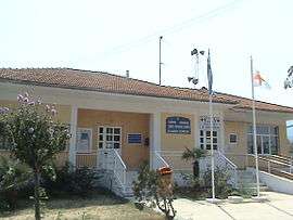
The community hall of Poroi | |
 Poroi | |
| Coordinates: 39°58.651′N 22°39′E / 39.977517°N 22.650°ECoordinates: 39°58.651′N 22°39′E / 39.977517°N 22.650°E | |
| Country | Greece |
| Administrative region | Central Macedonia |
| Regional unit | Pieria |
| Municipality | Dio-Olympos |
| Municipal unit | East Olympos |
| Highest elevation | 565 m (1,854 ft) |
| Lowest elevation | 2 m (7 ft) |
| Community[1] | |
| • Population | 770 (2011) |
| • Area (km2) | 26.889 |
| Time zone | EET (UTC+2) |
| • Summer (DST) | EEST (UTC+3) |
| Postal code | 600 65 |
| Area code(s) | +30-2352-xxx-xxx |
| Vehicle registration | KN |
Poroi (Greek: Πόροι) is a community of the Dio-Olympos municipality.[2] Before the 2011 local government reform it was part of the municipality of East Olympos, of which it was a municipal district.[2] The 2011 census recorded 770 inhabitants in the village.[1] The community of Poroi covers an area of 26.889 km2.[3]
Administrative division
The community of Poroi consists of three separate settlements:[1]
- Agios Dimitrios (population 14)
- Neoi Poroi (population 733)
- Palioi Poroi (population 23)
The aforementioned population figures are as of 2011.[1]
See also
References
- 1 2 3 4 "Απογραφή Πληθυσμού - Κατοικιών 2011. ΜΟΝΙΜΟΣ Πληθυσμός" (in Greek). Hellenic Statistical Authority.
- 1 2 Kallikratis law Greece Ministry of Interior (Greek)
- ↑ "Population & housing census 2001 (incl. area and average elevation)" (PDF) (in Greek). National Statistical Service of Greece.
This article is issued from Wikipedia - version of the 11/6/2016. The text is available under the Creative Commons Attribution/Share Alike but additional terms may apply for the media files.