Presentacion, Camarines Sur
| Presentacion | |
|---|---|
| Municipality | |
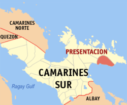 Map of Camarines Sur showing the location of Presentacion | |
.svg.png) Presentacion Location within the Philippines | |
| Coordinates: 13°43′N 123°45′E / 13.72°N 123.75°ECoordinates: 13°43′N 123°45′E / 13.72°N 123.75°E | |
| Country | Philippines |
| Region | Bicol (Region V) |
| Province | Camarines Sur |
| District | 4th district |
| Barangays | 18 |
| Government[1] | |
| • Mayor | Jaime Deleña |
| Area[2] | |
| • Total | 143.8 km2 (55.5 sq mi) |
| Population (2015 census)[3] | |
| • Total | 20,996 |
| • Density | 150/km2 (380/sq mi) |
| Time zone | PST (UTC+8) |
| ZIP code | 4424 |
| IDD : area code | +63 (0)54 |
| Income class | 4th class; coastal municipality |
Presentacion (formerly Parubcan) is a fourth class municipality in the province of Camarines Sur, Philippines. According to the 2015 census, it has a population of 20,996 people.[3]
Barangays
Presentacion is politically subdivided into 18 barangays.[2]
- Ayugao
- Bagong Sirang
- Baliguian
- Bantugan
- Bicalen
- Bitaogan
- Buenavista
- Bulalacao
- Cagnipa
- Lagha
- Lidong
- Liwacsa
- Maangas
- Pagsangaan
- Patrociño (Dalhugan)
- Pili
- Sta. Maria (Poblacion)
- Tanauan
Demographics
| Population census of Presentacion | ||
|---|---|---|
| Year | Pop. | ±% p.a. |
| 1990 | 14,788 | — |
| 1995 | 15,346 | +0.70% |
| 2000 | 16,410 | +1.45% |
| 2007 | 20,266 | +2.95% |
| 2010 | 20,023 | −0.44% |
| 2015 | 20,996 | +0.91% |
| Source: Philippine Statistics Authority[3][4][5] | ||
In the 2015 census, the population of Presentacion, Camarines Sur, was 20,996 people,[3] with a density of 150 inhabitants per square kilometre or 390 inhabitants per square mile.
See also
References
- ↑ "Municipalities". Quezon City, Philippines: Department of the Interior and Local Government. Retrieved 10 January 2013.
- 1 2 "Province: CAMARINES SUR". PSGC Interactive. Makati City, Philippines: National Statistical Coordination Board. Retrieved 10 January 2013.
- 1 2 3 4 "Region V (BICOL REGION)". Census of Population (2015): Total Population by Province, City, Municipality and Barangay (Report). PSA. Retrieved 20 June 2016.
- ↑ "Region V (BICOL REGION)". Census of Population and Housing (2010): Total Population by Province, City, Municipality and Barangay (Report). NSO. Retrieved 29 June 2016.
- ↑ "Province of Camarines Sur". Municipality Population Data. LWUA Research Division. Retrieved 24 July 2013.
External links
- Philippine Standard Geographic Code
- Philippine Census Information
- Official Site of the Province of Camarines Sur
 |
Garchitorena | | ||
| Lagonoy | |
Caramoan | ||
| ||||
| | ||||
| Lagonoy Gulf |
Pili (capital) | |
| Municipalities | |
| Component city | |
| Independent component city |
|
This article is issued from Wikipedia - version of the 11/29/2016. The text is available under the Creative Commons Attribution/Share Alike but additional terms may apply for the media files.