Ptujska Cesta
| Ptujska Cesta | |
|---|---|
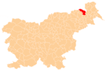
 Ptujska Cesta Location in Slovenia | |
| Coordinates: 46°38′9.95″N 15°59′33.15″E / 46.6360972°N 15.9925417°ECoordinates: 46°38′9.95″N 15°59′33.15″E / 46.6360972°N 15.9925417°E | |
| Country |
|
| Traditional region | Styria |
| Statistical region | Mura |
| Municipality | Gornja Radgona |
| Area | |
| • Total | 1.9 km2 (0.7 sq mi) |
| Elevation | 303.5 m (995.7 ft) |
| Population (2002) | |
| • Total | 232 |
| [1] | |
Ptujska Cesta (pronounced [ˈptuːi̯ska ˈtseːsta]) is a dispersed settlement in the hills west of Gornja Radgona in northeastern Slovenia.[2]
References
External links
| Settlements | Administrative centre: Gornja Radgona
|  |
|---|---|---|
| Landmarks |
| |
| Notable people |
| |
This article is issued from Wikipedia - version of the 8/24/2015. The text is available under the Creative Commons Attribution/Share Alike but additional terms may apply for the media files.