Raghtin More
| Raghtin More | |
|---|---|
| Reachtain Mhór | |
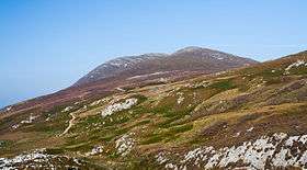 Raghtin More (left) as seen from Mamore Gap | |
| Highest point | |
| Elevation | 502 m (1,647 ft) [1] |
| Prominence | 407 m (1,335 ft) [1] |
| Listing | Marilyn |
| Coordinates | 55°12′21.24″N 7°28′1.2″W / 55.2059000°N 7.467000°WCoordinates: 55°12′21.24″N 7°28′1.2″W / 55.2059000°N 7.467000°W |
| Naming | |
| Translation | Big element (Irish) |
| Geography | |
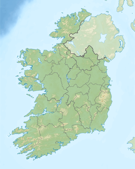 Raghtin More Ireland | |
| Location | County Donegal, Ireland |
| OSI/OSNI grid | C339455 |
| Geology | |
| Mountain type | manily of quartzite[2] |
| Climbing | |
| Easiest route | from Mamore Gap |
Raghtin More (Irish: Reachtain Mhór, meaning "great, big element")[3] is a mountain in Inishowen, County Donegal, Ireland.
Geography
The mountain is part of Inishowen peninsula and is the 557th highest in Ireland.[1]
History
On the mountain summit stands a megalithic cairn.[1]
Access to the summit

Triangulation pillar on the summit
Raghtin More summit can be reached with a medium walk from Marmore Gap.[1] From the top of the mountain there is an impressive view of the coast stretching till to Malin Head.[4]
References
- 1 2 3 4 5 "Inishowen Area Raghtin More". MountainViews. Ordnance Survey Ireland. Retrieved August 20, 2015.
- ↑ Ireland, Fionn Davenport; Lonely Planet, 2010
- ↑ "Reachtain Mhór". Placenames Database of Ireland. Dublin City University. Retrieved August 20, 2015.
- ↑ Hiking in Ireland, Helen Fairbairn, Gareth McCormack; Lonely Planet, 2010
![]() Media related to Raghtin More at Wikimedia Commons
Media related to Raghtin More at Wikimedia Commons
Mountains and hills of Ulster | ||
|---|---|---|
| Antrim Hills | 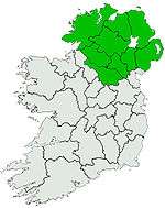 | |
| Antrim Plateau | ||
| Belfast Hills | ||
| Croaghgorms | ||
| Derryveagh | ||
| Inishowen | ||
| Mournes | ||
| Sperrins | ||
| Southwest Donegal | ||
| Others | ||
Lists of Marilyns | |
|---|---|
This article is issued from Wikipedia - version of the 9/24/2016. The text is available under the Creative Commons Attribution/Share Alike but additional terms may apply for the media files.