Rance (river)
| Rance | |
|---|---|
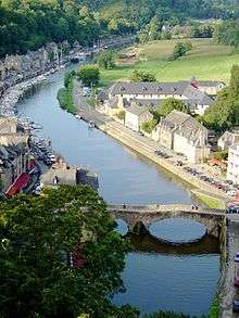 The Rance in Dinan. | |
| Native name | Breton: Renk, French: La Rance |
| Country | France |
| Basin | |
| Main source | Brittany |
| River mouth |
English Channel 48°38′28″N 2°2′26″W / 48.64111°N 2.04056°WCoordinates: 48°38′28″N 2°2′26″W / 48.64111°N 2.04056°W |
| Basin size | 1,195 km2 (461 sq mi) |
| Physical characteristics | |
| Length | 102 km (63 mi) |
| Discharge |
|
The Rance (Breton: Renk, French: La Rance) is a river of northwestern France.[1] It flows into the English Channel between Dinard and Saint-Malo.
Before reaching the Channel, its waters are barred by a 750 metre long dam forming the Rance tidal power plant.
The river is linked to the Vilaine by means of the Canal d'Ille-et-Rance.
Départements and towns along the river:
Hydrology and water quality
Tributaries of the Rance include:
- Croqueloir
- Clergé
- Fremeur
- Quinéford
This river has moderate turbidity and its brownish water is somewhat low in velocity due to the slight gradient of the watercourse; pH levels have been measured at 8.13[2] within the city of Dinan and electrical conductivity of the waters have tested at 33 micro-siemens per centimetre. At this reference location, summer flows are typically in the range of 500 cubic feet per second (14 m3/s).