Renneville, Eure
| Renneville | |
|---|---|
 Renneville | |
|
Location within Normandy region 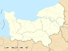 Renneville | |
| Coordinates: 49°24′12″N 1°19′17″E / 49.4033°N 1.3214°ECoordinates: 49°24′12″N 1°19′17″E / 49.4033°N 1.3214°E | |
| Country | France |
| Region | Normandy |
| Department | Eure |
| Arrondissement | Les Andelys |
| Canton | Fleury-sur-Andelle |
| Government | |
| • Mayor (2014–2020) | Gilles Vieillard |
| Area1 | 6.3 km2 (2.4 sq mi) |
| Population (2008)2 | 244 |
| • Density | 39/km2 (100/sq mi) |
| Time zone | CET (UTC+1) |
| • Summer (DST) | CEST (UTC+2) |
| INSEE/Postal code | 27488 / 27910 |
| Elevation |
78–153 m (256–502 ft) (avg. 143 m or 469 ft) |
|
1 French Land Register data, which excludes lakes, ponds, glaciers > 1 km² (0.386 sq mi or 247 acres) and river estuaries. 2 Population without double counting: residents of multiple communes (e.g., students and military personnel) only counted once. | |
Renneville is a commune in the Eure department in northern France.
Population
| Historical population | ||
|---|---|---|
| Year | Pop. | ±% |
| 1962 | 99 | — |
| 1968 | 110 | +11.1% |
| 1975 | 117 | +6.4% |
| 1982 | 150 | +28.2% |
| 1990 | 200 | +33.3% |
| 1999 | 201 | +0.5% |
| 2008 | 244 | +21.4% |
See also
References
| Wikimedia Commons has media related to Renneville (Eure). |
This article is issued from Wikipedia - version of the 3/15/2016. The text is available under the Creative Commons Attribution/Share Alike but additional terms may apply for the media files.