Retranchement
| Retranchement | ||
|---|---|---|
| ||
| Coordinates: 51°20′52″N 3°23′5″E / 51.34778°N 3.38472°E | ||
| Country | Netherlands | |
| Province | Zeeland | |
| Municipality | Sluis | |
| Population (1 January 2009) | 415 | |
Retranchement is a village in the Dutch province of Zeeland. It is located on the Belgian border, about 9 km northwest of Oostburg, in the municipality of Sluis.
Retranchement was a separate municipality until 1970, when it was merged with Sluis.[1]
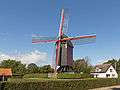 Windmill: de Retranchementse Molen
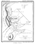 Map (1866)
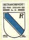 Coat of arms of Retranchement
References
- ↑ Ad van der Meer and Onno Boonstra, Repertorium van Nederlandse gemeenten, KNAW, 2006.
External links
- J. Kuyper, Gemeente Atlas van Nederland, 1865-1870, "Retranchement". Map of the former municipality, around 1868.
Coordinates: 51°21′N 3°23′E / 51.350°N 3.383°E
This article is issued from Wikipedia - version of the 3/11/2016. The text is available under the Creative Commons Attribution/Share Alike but additional terms may apply for the media files.