Roerdalen
| Roerdalen Roerdale | |||
|---|---|---|---|
| Municipality | |||
|
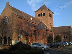
Church in Melick | |||
| |||
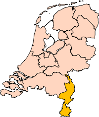
.svg.png) Location in Limburg | |||
| Coordinates: 51°9′N 6°0′E / 51.150°N 6.000°ECoordinates: 51°9′N 6°0′E / 51.150°N 6.000°E | |||
| Country | Netherlands | ||
| Province | Limburg | ||
| Established | 1 January 1991 | ||
| Government[1] | |||
| • Body | Municipal council | ||
| • Mayor | Monique de Boer-Beerta (VVD) | ||
| Area[2] | |||
| • Total | 88.70 km2 (34.25 sq mi) | ||
| • Land | 88.15 km2 (34.03 sq mi) | ||
| • Water | 0.55 km2 (0.21 sq mi) | ||
| Elevation[3] | 28 m (92 ft) | ||
| Population (May 2014)[4] | |||
| • Total | 20,774 | ||
| • Density | 236/km2 (610/sq mi) | ||
| Time zone | CET (UTC+1) | ||
| • Summer (DST) | CEST (UTC+2) | ||
| Postcode | 6060–6065, 6074–6077 | ||
| Area code | 0475 | ||
| Website |
www | ||


Roerdalen (![]() pronunciation ) (Limburgish: Roerdale) is a municipality in the southeastern Netherlands, in the province of Limburg. As of 2007, it had about 21,000 inhabitants and borders Germany.
pronunciation ) (Limburgish: Roerdale) is a municipality in the southeastern Netherlands, in the province of Limburg. As of 2007, it had about 21,000 inhabitants and borders Germany.
Population centres
- Herkenbosch
- Melick
- Montfort
- Posterholt
- Reutje
- Sint Odiliënberg
- Vlodrop
Topography
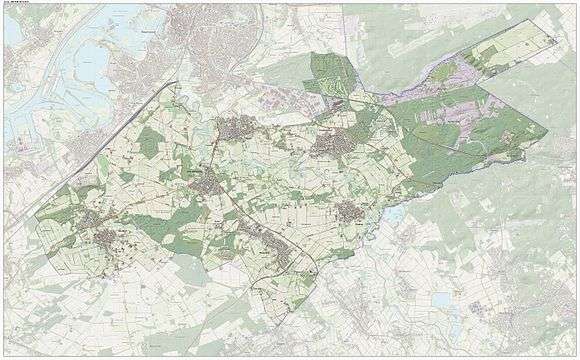
Dutch Topographic map of the municipality of Roerdalen, June 2015
Gallery
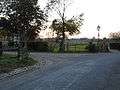 Melick
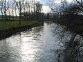 River Roer
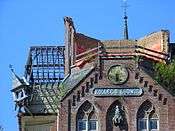 Ruined Building detail of Kolleg St. Ludwig
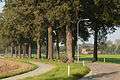 Road between St. Odilienberg Paarlo, looking towards St. Odilienberg
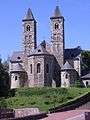 Basiliek van de H.H. Wiro
 Windmill (molen van Verbeek) in Sint Odiliënberg
_church.JPG) Montfort church
Montfort church_Rijksmonument_47063_pastorie.JPG) Montfort former vicarage.
Montfort former vicarage.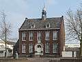 Montfort former townhall
_Rijksmonument_30068_De_Voorhof.JPG) Voorhof
Voorhof_sculpture_by_Nicolas_van_Ronkenstein.JPG) Sculpture by Nicolas van Ronkenstein
Sculpture by Nicolas van Ronkensteinb.JPG) Mill in St. Odiliënberg
Mill in St. Odiliënberg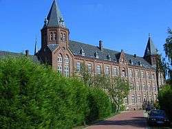 Vlodrop
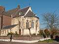 Church (de Sint Sebastianuskerk) in Herkenbosch
References
- ↑ "Samenstelling college B&W" [Members of the board of mayor and aldermen] (in Dutch). Gemeente Roerdalen. Retrieved 21 November 2013.
- ↑ "Kerncijfers wijken en buurten" [Key figures for neighbourhoods]. CBS Statline (in Dutch). CBS. 2 July 2013. Retrieved 12 March 2014.
- ↑ "Postcodetool for 6077CG". Actueel Hoogtebestand Nederland (in Dutch). Het Waterschapshuis. Retrieved 21 November 2013.
- ↑ "Bevolkingsontwikkeling; regio per maand" [Population growth; regions per month]. CBS Statline (in Dutch). CBS. 26 June 2014. Retrieved 24 July 2014.
External links
 Media related to Roerdalen at Wikimedia Commons
- (Dutch) Official website
 |
Roermond | Niederkrüchten (DE-NW) | | |
| Maasgouw | |
Wegberg (DE-NW) | ||
| ||||
| | ||||
| Echt-Susteren | Waldfeucht (DE-NW), Heinsberg (DE-NW) | Wassenberg (DE-NW) |
This article is issued from Wikipedia - version of the 6/25/2016. The text is available under the Creative Commons Attribution/Share Alike but additional terms may apply for the media files.