Roupov
| Roupov | |
|---|---|
| Municipality | |
 Roupov | |
| Coordinates: 49°32′28″N 13°14′58″E / 49.54111°N 13.24944°ECoordinates: 49°32′28″N 13°14′58″E / 49.54111°N 13.24944°E | |
| Country |
|
| Region | Plzeň |
| District | Plzeň-South |
| Area | |
| • Total | 7.05 km2 (2.72 sq mi) |
| Elevation | 427 m (1,401 ft) |
| Population (2006) | |
| • Total | 248 |
| • Density | 35/km2 (91/sq mi) |
| Postal code | 334 53 |
Roupov is a village and municipality (obec) in Plzeň-South District in the Plzeň Region of the Czech Republic.
The municipality covers an area of 7.05 square kilometres (2.72 sq mi), and has a population of 248 (as at 28 August 2006).
Roupov lies approximately 25 kilometres (16 mi) south of Plzeň and 104 km (65 mi) south-west of Prague.
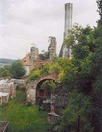 Ruin of castle in village Roupov
References
| Wikimedia Commons has media related to Roupov. |
This article is issued from Wikipedia - version of the 4/7/2016. The text is available under the Creative Commons Attribution/Share Alike but additional terms may apply for the media files.