S2 (Berlin)
| S2 | |
| Stations | Transfers |
|---|---|
| Blankenfelde | DB |
| Mahlow | |
| Berlin city limit | |
| Lichtenrade | |
| Schichauweg | |
| Buckower Chaussee | |
| Marienfelde | |
| Attilastraße | |
| Priesterweg | S25 |
| Südkreuz | S25, S41, S42, S45, S46, DB |
| Yorckstraße | U7, S1, S25 |
| Anhalter Bahnhof | S1, S25 |
| Potsdamer Platz | U2, S1, S25, DB |
| Brandenburger Tor | U55, S1, S25 |
| Friedrichstraße | U6, S1, S25, S5, S7, S75, DB |
| Oranienburger Straße | S1, S25 |
| Nordbahnhof | S1, S25 |
| Humboldthain | S1, S25 |
| Gesundbrunnen | U8, S1, S25, S41, S42, DB |
| Bornholmer Straße | S1, S25, S8, S85, S9 |
| Pankow | U2, S8, S9 |
| Pankow-Heinersdorf | S8 |
| Blankenburg | S8 |
| Karow | DB |
| Buch | |
| Berlin city limit | |
| Röntgental | |
| Zepernick | |
| Bernau-Friedenstal | |
| Bernau bei Berlin | DB |
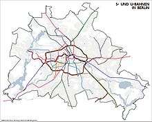
S2 is a line on the Berlin S-Bahn.[1] It operates from Bernau to Blankenfelde over:
- the Berlin-Szczecin railway, opened on 1 August 1842 and electrified on 8 August 1924,
- the Nord-Süd-Tunnel, opened on 28 May 1936 from Humboldthain to Unter den Linden and on 6 November 1939 to Anhalter Bahnhof and Priesterweg
- the Berlin–Dresden railway, opened on 17 June 1875 and electrified on 15 May 1933.
References
- ↑ "S-Bahn Network Map" (pdf). S-Bahn Berlin GmbH. 2008-06-27. Retrieved 2009-07-07.
This article is issued from Wikipedia - version of the 3/12/2013. The text is available under the Creative Commons Attribution/Share Alike but additional terms may apply for the media files.