Saint-André-d'Embrun
| Saint-André-d'Embrun | ||
|---|---|---|
|
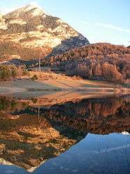
Siguret Lake | ||
| ||
 Saint-André-d'Embrun | ||
|
Location within Provence-A.-C.d'A. region 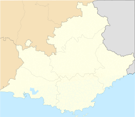 Saint-André-d'Embrun | ||
| Coordinates: 44°35′12″N 6°32′05″E / 44.5867°N 6.5347°ECoordinates: 44°35′12″N 6°32′05″E / 44.5867°N 6.5347°E | ||
| Country | France | |
| Region | Provence-Alpes-Côte d'Azur | |
| Department | Hautes-Alpes | |
| Arrondissement | Gap | |
| Canton | Embrun | |
| Intercommunality | Embrunais | |
| Government | ||
| • Mayor (2008–2014) | Marc Zanetto (PR) | |
| Area1 | 38.63 km2 (14.92 sq mi) | |
| Population (2008)2 | 637 | |
| • Density | 16/km2 (43/sq mi) | |
| Time zone | CET (UTC+1) | |
| • Summer (DST) | CEST (UTC+2) | |
| INSEE/Postal code | 05128 / 05200 | |
| Elevation |
796–2,934 m (2,612–9,626 ft) (avg. 920 m or 3,020 ft) | |
|
1 French Land Register data, which excludes lakes, ponds, glaciers > 1 km² (0.386 sq mi or 247 acres) and river estuaries. 2 Population without double counting: residents of multiple communes (e.g., students and military personnel) only counted once. | ||

Saint-André-d'Embrun is a commune in the Hautes-Alpes department in southeastern France. Surrounded by the towns of Chateauroux-les-Alpes, Embrun and Crévoux, Saint-André-d'Embrun is located 36 km northeast of Gap, the largest city nearby.[1]
Population
| Historical population | ||
|---|---|---|
| Year | Pop. | ±% |
| 1962 | 412 | — |
| 1968 | 415 | +0.7% |
| 1975 | 361 | −13.0% |
| 1982 | 462 | +28.0% |
| 1990 | 417 | −9.7% |
| 1999 | 495 | +18.7% |
| 2008 | 637 | +28.7% |
See also
References
| Wikimedia Commons has media related to Saint-André-d'Embrun. |
This article is issued from Wikipedia - version of the 1/17/2015. The text is available under the Creative Commons Attribution/Share Alike but additional terms may apply for the media files.