Saint-Georges-de-l'Oyapock Airport
| St-Georges-de-l'Oyapock Airport | |||||||||||
|---|---|---|---|---|---|---|---|---|---|---|---|
| IATA: OYP – ICAO: SOOG | |||||||||||
| Summary | |||||||||||
| Airport type | Public | ||||||||||
| Operator | Conseil général de la Guyane | ||||||||||
| Serves | St-Georges-de-l'Oyapock, French Guiana | ||||||||||
| Elevation AMSL | 36 ft / 11 m | ||||||||||
| Coordinates | 3°53′50″N 51°48′15″W / 3.89722°N 51.80417°W | ||||||||||
| Map | |||||||||||
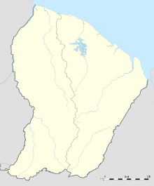 OYP Location in French Guiana | |||||||||||
| Runways | |||||||||||
| |||||||||||
Saint-Georges-de-l'Oyapock Airport (IATA: OYP, ICAO: SOOG) is an airport serving Saint-Georges (also known as Saint-Georges-de-l'Oyapock) in French Guiana.[1] Saint-Georges lies on the Oyapock River, which forms the border between French Guiana and Brazil.
The Saint Georges non-directional beacon (Ident: GOP) is located on the field.[5]
See also
 French Guiana portal
 Aviation portal
- List of airports in French Guiana
- Transport in French Guiana
References
- 1 2 SOOG – Saint Georges de l'Oyapock. AIP from French Service d'information aéronautique, effective 8 December 2016.
- ↑ Airport information for SOOG from DAFIF (effective October 2006)
- ↑ Airport information for OYP at Great Circle Mapper. Source: DAFIF (effective October 2006).
- ↑ Google Maps - Saint Georges
- ↑ SkyVector Aeronautical Charts
External links
This article is issued from Wikipedia - version of the 5/28/2016. The text is available under the Creative Commons Attribution/Share Alike but additional terms may apply for the media files.