Saint-Goussaud
| Saint-Goussaud | |
|---|---|
|
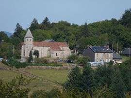
The church and surrounding buildings in Saint-Goussaud | |
 Saint-Goussaud | |
|
Location within Nouvelle-Aquitaine region  Saint-Goussaud | |
| Coordinates: 46°02′29″N 1°34′44″E / 46.0414°N 1.5789°ECoordinates: 46°02′29″N 1°34′44″E / 46.0414°N 1.5789°E | |
| Country | France |
| Region | Nouvelle-Aquitaine |
| Department | Creuse |
| Arrondissement | Guéret |
| Canton | Bénévent-l'Abbaye |
| Intercommunality | Bénévent-Grand-Bourg |
| Government | |
| • Mayor (2008–2014) | Patrick Dourdy |
| Area1 | 24.3 km2 (9.4 sq mi) |
| Population (2008)2 | 205 |
| • Density | 8.4/km2 (22/sq mi) |
| Time zone | CET (UTC+1) |
| • Summer (DST) | CEST (UTC+2) |
| INSEE/Postal code | 23200 / 23430 |
| Elevation |
377–693 m (1,237–2,274 ft) (avg. 672 m or 2,205 ft) |
|
1 French Land Register data, which excludes lakes, ponds, glaciers > 1 km² (0.386 sq mi or 247 acres) and river estuaries. 2 Population without double counting: residents of multiple communes (e.g., students and military personnel) only counted once. | |
Saint-Goussaud is a commune in the Creuse department in central France.
Population
| Historical population | ||
|---|---|---|
| Year | Pop. | ±% |
| 1962 | 299 | — |
| 1968 | 353 | +18.1% |
| 1975 | 285 | −19.3% |
| 1982 | 271 | −4.9% |
| 1990 | 238 | −12.2% |
| 1999 | 213 | −10.5% |
| 2008 | 205 | −3.8% |
See also
References
| Wikimedia Commons has media related to Saint-Goussaud. |
This article is issued from Wikipedia - version of the 8/16/2016. The text is available under the Creative Commons Attribution/Share Alike but additional terms may apply for the media files.