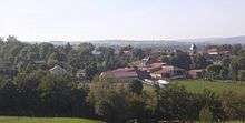
Saint-Mary-le-Plain
| Saint-Mary-le-Plain | |
|---|---|
|
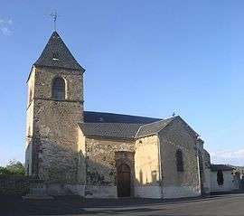
The church in Saint-Mary-le-Plain | |
 Saint-Mary-le-Plain | |
|
Location within Auvergne-Rhône-Alpes region  Saint-Mary-le-Plain | |
| Coordinates: 45°11′15″N 3°09′45″E / 45.1875°N 3.1625°ECoordinates: 45°11′15″N 3°09′45″E / 45.1875°N 3.1625°E | |
| Country | France |
| Region | Auvergne-Rhône-Alpes |
| Department | Cantal |
| Arrondissement | Saint-Flour |
| Canton | Massiac |
| Intercommunality | Pays de Massiac |
| Government | |
| • Mayor (2008–2014) | Nadia Levet |
| Area1 | 21.8 km2 (8.4 sq mi) |
| Population (2008)2 | 156 |
| • Density | 7.2/km2 (19/sq mi) |
| Time zone | CET (UTC+1) |
| • Summer (DST) | CEST (UTC+2) |
| INSEE/Postal code | 15203 / 15500 |
| Elevation |
640–1,021 m (2,100–3,350 ft) (avg. 867 m or 2,844 ft) |
|
1 French Land Register data, which excludes lakes, ponds, glaciers > 1 km² (0.386 sq mi or 247 acres) and river estuaries. 2 Population without double counting: residents of multiple communes (e.g., students and military personnel) only counted once. | |
Saint-Mary-le-Plain is a commune in the Cantal department in south-central France.
Population
| Historical population | ||
|---|---|---|
| Year | Pop. | ±% |
| 1962 | 262 | — |
| 1968 | 284 | +8.4% |
| 1975 | 245 | −13.7% |
| 1982 | 206 | −15.9% |
| 1990 | 172 | −16.5% |
| 1999 | 156 | −9.3% |
| 2008 | 156 | +0.0% |
See also
References
| Wikimedia Commons has media related to Saint-Mary-le-Plain. |
This article is issued from Wikipedia - version of the 7/12/2016. The text is available under the Creative Commons Attribution/Share Alike but additional terms may apply for the media files.