Sant Alís
| Sant Alís | |
|---|---|
 | |
| Highest point | |
| Elevation | 1,675 m (5,495 ft) |
| Coordinates | 42°2′23.24″N 0°45′59.70″E / 42.0397889°N 0.7665833°ECoordinates: 42°2′23.24″N 0°45′59.70″E / 42.0397889°N 0.7665833°E |
| Geography | |
| Location | Pre-Pyrenees, Catalonia |
| Parent range | Serra del Montsec |
| Geology | |
| Mountain type | Calcareous |
| Climbing | |
| Easiest route | From Àger |
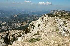
Sant Alís is the highest mountain of the Serra del Montsec, Catalonia, Spain. It has an elevation of 1,675 metres above sea level.[1]
See also
References
- ↑ "Mapa Topogràfic de Catalunya". Institut Cartogràfic de Catalunya. Retrieved May 22, 2010..
This article is issued from Wikipedia - version of the 8/27/2015. The text is available under the Creative Commons Attribution/Share Alike but additional terms may apply for the media files.