Santa Teresita, Cagayan
| Santa Teresita | |
|---|---|
| Municipality | |
| Nickname(s): Vannamei Capital of the Philippines; Youngest Town of Cagayan | |
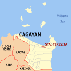 Map of Cagayan showing the location of Santa Teresita | |
.svg.png) Sta. Teresita Location within the Philippines | |
| Coordinates: 18°15′N 121°53′E / 18.25°N 121.88°ECoordinates: 18°15′N 121°53′E / 18.25°N 121.88°E | |
| Country | Philippines |
| Region | Cagayan Valley (Region II) |
| Province | Cagayan |
| District | 1st District |
| Barangays | 13 |
| Government[1] | |
| • Mayor | Lolita Dela Cruz-Garcia |
| Area[2] | |
| • Total | 166.98 km2 (64.47 sq mi) |
| Population (2015 census)[3] | |
| • Total | 19,038 |
| • Density | 110/km2 (300/sq mi) |
| Time zone | PST (UTC+8) |
| ZIP code | 3512 |
| IDD : area code | +63 (0)78 |
| Income class | 4th class |
Santa Teresita is a fourth class municipality in the province of Cagayan, Philippines. According to the 2015 census, it has a population of 19,038 people.[3]
Barangays
Sta. Teresita is politically subdivided into 13 barangays.[2]
- Alucao
- Buyun
- Centro East (Pob.)
- Centro West
- Dungeg
- Luga
- Masi
- Mission
- Simpatuyo
- Villa
- Aridowen
- Caniugan
- Simbaluca
Demographics
| Population census of Santa Teresita | ||
|---|---|---|
| Year | Pop. | ±% p.a. |
| 1990 | 11,557 | — |
| 1995 | 12,566 | +1.58% |
| 2000 | 13,804 | +2.03% |
| 2007 | 16,578 | +2.56% |
| 2010 | 17,600 | +2.20% |
| 2015 | 19,038 | +1.51% |
| Source: Philippine Statistics Authority[3][4] | ||
In the 2015 census, the population of Santa Teresita, Cagayan, was 19,038 people,[3] with a density of 110 inhabitants per square kilometre or 280 inhabitants per square mile.
References
- ↑ "Official City/Municipal 2013 Election Results". Intramuros, Manila, Philippines: Commission on Elections (COMELEC). 11 September 2013. Retrieved 24 January 2014.
- 1 2 "Province: CAGAYAN". PSGC Interactive. Makati City, Philippines: National Statistical Coordination Board. Retrieved 24 January 2014.
- 1 2 3 4 "Region II (CAGAYAN VALLEY)". Census of Population (2015): Total Population by Province, City, Municipality and Barangay (Report). PSA. Retrieved 20 June 2016.
- ↑ "Region II (CAGAYAN VALLEY)". Census of Population and Housing (2010): Total Population by Province, City, Municipality and Barangay (Report). NSO. Retrieved 29 June 2016.
External links
 |
Babuyan Channel (Luzon Strait) | | ||
| Buguey | |
Gonzaga | ||
| ||||
| | ||||
| Lal-Lo |
Tuguegarao (capital) | |
| Municipalities | |
| Component city | |
| Barangays | |
This article is issued from Wikipedia - version of the 12/1/2016. The text is available under the Creative Commons Attribution/Share Alike but additional terms may apply for the media files.