Scheinberg
| Scheinberg (Steigerwald) | |
|---|---|
| Highest point | |
| Elevation | 498 m above sea level (NHN) (1,634 ft) |
| Coordinates | 49°36′51″N 10°17′14″E / 49.61417°N 10.28722°ECoordinates: 49°36′51″N 10°17′14″E / 49.61417°N 10.28722°E |
| Geography | |
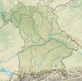
| Location | Bavaria, Germany |
| State/Province | DE-BY |
| Parent range | Steigerwald |
The Scheinberg is a hill, 498 m above NHN,[1] and the highest point in the Steigerwald, a hill range in southern Germany. It lies northeast of Ippesheim in the county of Neustadt an der Aisch-Bad Windsheim in Middle Franconia. To the north runs the border with the Lower Franconian province of Kitzingen.
References
This article is issued from Wikipedia - version of the 7/16/2016. The text is available under the Creative Commons Attribution/Share Alike but additional terms may apply for the media files.