Schleching
| Schleching | ||
|---|---|---|
| ||
 Schleching | ||
Location of Schleching within Traunstein district 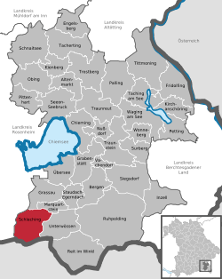 | ||
| Coordinates: 47°43′N 12°24′E / 47.717°N 12.400°ECoordinates: 47°43′N 12°24′E / 47.717°N 12.400°E | ||
| Country | Germany | |
| State | Bavaria | |
| Admin. region | Oberbayern | |
| District | Traunstein | |
| Government | ||
| • Mayor | Josef Loferer | |
| Area | ||
| • Total | 45.17 km2 (17.44 sq mi) | |
| Population (2015-12-31)[1] | ||
| • Total | 1,783 | |
| • Density | 39/km2 (100/sq mi) | |
| Time zone | CET/CEST (UTC+1/+2) | |
| Postal codes | 83259 | |
| Dialling codes | 08649 | |
| Vehicle registration | TS | |
| Website | www.schleching.de | |

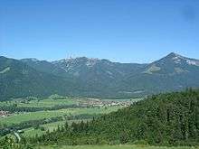
Schleching with Kampenwand and Hochplatte
Schleching is a municipality in the district of Traunstein in Bavaria, Germany.
References
- ↑ "Fortschreibung des Bevölkerungsstandes". Bayerisches Landesamt für Statistik und Datenverarbeitung (in German). June 2016.
This article is issued from Wikipedia - version of the 5/20/2015. The text is available under the Creative Commons Attribution/Share Alike but additional terms may apply for the media files.