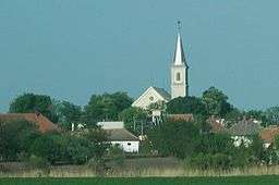
Sekule
| Sekule | |
| Village | |
 | |
| Country | Slovakia |
|---|---|
| Region | Trnava |
| District | Senica |
| Elevation | 153 m (502 ft) |
| Coordinates | SK 48°36′N 17°00′E / 48.600°N 17.000°ECoordinates: SK 48°36′N 17°00′E / 48.600°N 17.000°E |
| Area | 23.49 km2 (9.07 sq mi) |
| Population | 1,633 (2004-12-31) |
| Density | 70/km2 (181/sq mi) |
| First mentioned | 1402 |
| Timezone | CET (UTC+1) |
| - summer (DST) | CEST (UTC+2) |
| Postal code | 908 80 |
| Car plate | SE |
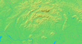  Location of Sekule in Slovakia | |
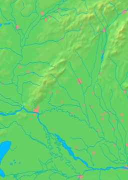  Location of Sekule in the Trnava Region | |
| Statistics: MOŠ/MIS | |
Sekule is a village and municipality in Senica District in the Trnava Region of western Slovakia.
Etymology
The name is derived from the ethnonym Székelys (Slovak: Sikuli), one of the tribes who guarded the frontier area.[1]
History
In historical records the village was first mentioned in 1402.
Geography
The municipality lies at an altitude of 153 metres and covers an area of 23.492km². It has a population of about 1,633 people.
References
- ↑ Závodný, Andrej (2007). "O názvoch riek a potokov na Záhorí" [About the river and creek names in Záhorie]. Záhorie (in Slovak). SKalica: Záhorské múzeum v Skalici (1).
External links
Municipalities of Senica District | ||
|---|---|---|
This article is issued from Wikipedia - version of the 11/20/2016. The text is available under the Creative Commons Attribution/Share Alike but additional terms may apply for the media files.