Selbsanft
| Selbsanft | |
|---|---|
| Hinter Selbsanft | |
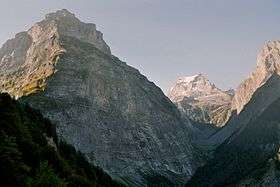 Selbsanft (left) and Tödi (right) | |
| Highest point | |
| Elevation | 3,029 m (9,938 ft) |
| Prominence | 180 m (590 ft) [1] |
| Parent peak | Tödi |
| Coordinates | 46°49′54.1″N 8°58′41.6″E / 46.831694°N 8.978222°ECoordinates: 46°49′54.1″N 8°58′41.6″E / 46.831694°N 8.978222°E |
| Geography | |
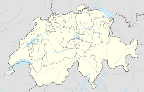 Selbsanft Location in Switzerland | |
| Location | Glarus, Switzerland |
| Parent range | Glarus Alps |
The Selbsanft is a mountain in the Glarus Alps, overlooking the village of Linthal in the canton of Glarus. The Selbsanft is a large mountain consisting of several summits of which the highest is named Hinter Selbsanft. The massif is a buttress of the Bifertenstock and forms, along with Schiben, the ridge that separates the valleys of the Sand (west) and Limmernsee (east). A small glacier lies east of the summit.[2]
The mountain lies within the municipality of Glarus Süd.[2]
References
- ↑ Retrieved from the Swisstopo topographic maps. The key col is the Griessloch (2,849 m).
- 1 2 map.geo.admin.ch (Map). Swiss Confederation. Retrieved 2015-06-05.
External links
 Media related to Selbsanft at Wikimedia Commons
- Selbsanft on Hikr
This article is issued from Wikipedia - version of the 5/9/2016. The text is available under the Creative Commons Attribution/Share Alike but additional terms may apply for the media files.