Serri
| Serri | |
|---|---|
| Comune | |
| Comune di Serri | |
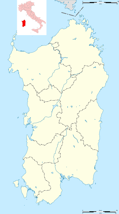 Serri Location of Serri in Sardinia | |
| Coordinates: 39°42′N 9°9′E / 39.700°N 9.150°ECoordinates: 39°42′N 9°9′E / 39.700°N 9.150°E | |
| Country | Italy |
| Region | Sardinia |
| Province / Metropolitan city | Province of Cagliari (CA) |
| Area | |
| • Total | 19.1 km2 (7.4 sq mi) |
| Population (Dec. 2004) | |
| • Total | 725 |
| • Density | 38/km2 (98/sq mi) |
| Time zone | CET (UTC+1) |
| • Summer (DST) | CEST (UTC+2) |
| Postal code | 08030 |
| Dialing code | 0782 |
Serri (Latin: Biora[1]) is a comune (municipality) in the Province of Cagliari in the Italian region Sardinia, located about 50 kilometres (31 mi) north of Cagliari. As of 31 December 2004, it had a population of 725 and an area of 19.1 square kilometres (7.4 sq mi).[2]
Serri borders the following municipalities: Escolca, Gergei, Isili, Mandas, Nurri.
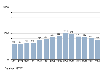
Demographic evolution
References
| Wikimedia Commons has media related to Serri. |
- ↑ Richard Talbert, Barrington Atlas of the Greek and Roman World, (ISBN 0-691-03169-X), Map 48.
- ↑ All demographics and other statistics: Italian statistical institute Istat.
This article is issued from Wikipedia - version of the 5/3/2015. The text is available under the Creative Commons Attribution/Share Alike but additional terms may apply for the media files.