Shoal Lake 39
| Shoal Lake 39 | |
|---|---|
| Indian reserve | |
| Shoal Lake Indian Reserve No. 39 | |
 Shoal Lake 39 | |
| Coordinates: 49°30′N 95°09′W / 49.500°N 95.150°WCoordinates: 49°30′N 95°09′W / 49.500°N 95.150°W | |
| Country |
|
| Provinces |
|
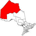
| Division / District | Division 1 / Kenora |
| First Nation | Iskatewizaagegan 39 |
| Area[1] | |
| • Land | 4.19 km2 (1.62 sq mi) |
Shoal Lake 39 is a First Nations reserve[1] on Shoal Lake straddling the border between Manitoba and Ontario. It is one of the reserves of the Iskatewizaagegan 39 Independent First Nation.
References
External links
 |
|
|
Shoal Lake |
|
| |
|
Shoal Lake | ||
| ||||
| | ||||
| |
Division 1, Manitoba (Eastern Manitoba) | ||
|---|---|---|
| Towns | 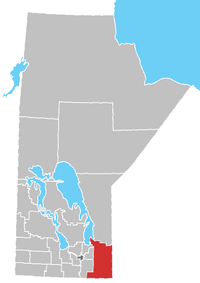 | |
| Local government districts | ||
| Rural municipalities | ||
| First Nations | ||
| Indian reserves |
| |
| Unorganized areas | ||
| Unincorporated communities | ||
This article is issued from Wikipedia - version of the 11/20/2016. The text is available under the Creative Commons Attribution/Share Alike but additional terms may apply for the media files.