Shurnukh
| Shurnukh Շուռնուխ | |
|---|---|
| community | |
 Shurnukh | |
| Coordinates: 39°22′39″N 46°23′29″E / 39.37750°N 46.39139°ECoordinates: 39°22′39″N 46°23′29″E / 39.37750°N 46.39139°E | |
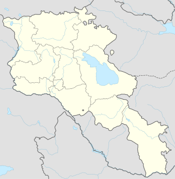
| Country |
|
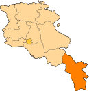
| Marz (Province) | Syunik |
| Area[1] | |
| • Total | 8.83 km2 (3.41 sq mi) |
| Population (2011) | |
| • Total | 207 |
| • Density | 23/km2 (61/sq mi) |
| Time zone | (UTC+4) |
| Shurnukh at GEOnet Names Server | |
Shurnukh (Armenian: Շուռնուխ) is a village and rural community (municipality) in the Syunik Province of Armenia.[2] The community includes the villages of Shurnukh, Vanand, Aghbulagh, and Dzorak.[2]
The community's population was 207 in 2011,[3] down from 224 in 2010.[2] The village had a population of 207 at the 2011 census,[3] up from 148 at the 2001 census.[4]
References
- ↑ Region.mtaes.am/ "Syunik regional e-Governance System" Check
|url=value (help) (in Armenian). Syunik Region Province provincial government. Click on link entitled "Համայնքներ" (community) and search for the place by Armenian name. - 1 2 3 "Marzes of the Republic of Armenia and Yerevan City in Figures, 2010" (PDF). National Statistical Service of the Republic of Armenia (ARMSTAT).
- 1 2 "Report of the Results of the 2011 Armenian Census" (PDF). National Statistical Service of the Republic of Armenia.
- ↑ Report of the results of the 2001 Armenian Census, National Statistical Service of the Republic of Armenia
This article is issued from Wikipedia - version of the 10/31/2015. The text is available under the Creative Commons Attribution/Share Alike but additional terms may apply for the media files.