Siay, Zamboanga Sibugay
| Siay | |
|---|---|
| Municipality | |
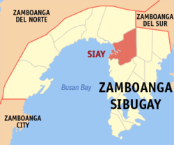 Map of Zamboanga Sibugay with Siay highlighted | |
.svg.png) Siay Location within the Philippines | |
| Coordinates: 07°43′N 122°53′E / 7.717°N 122.883°ECoordinates: 07°43′N 122°53′E / 7.717°N 122.883°E | |
| Country | Philippines |
| Region | Zamboanga Peninsula (Region IX) |
| Province | Zamboanga Sibugay |
| District | 2nd District of Zamboanga Sibugay |
| Founded | December 28, 1956 |
| Barangays | 29 |
| Government[1] | |
| • Mayor | Jarvis M. Acosta |
| • Vice Mayor | Gerald M. Acosta |
| Area[2] | |
| • Total | 313.66 km2 (121.10 sq mi) |
| Population (2015)[3] | |
| • Total | 41,572 |
| • Density | 130/km2 (340/sq mi) |
| Time zone | PST (UTC+8) |
| ZIP code | 7006 |
| Dialing code | 62 |
| Income class | 2nd class |
Siay is a second class municipality in the province of Zamboanga Sibugay, Philippines. According to the 2015 census, it has a population of 41,572 people.[3]
Barangays
Siay is politically subdivided into 29 barangays.[2] {{columns-list
- Balagon
- Balingasan
- Balucanan
- Bataan (Dacanay)
- Batu
- Buyogan
- Camanga
- Coloran
- Kimos (Kima)
- Labasan
- Lagting
- Laih
- Logpond
- Magsaysay
- Mahayahay
- Maligaya
- Maniha
- Minsulao
- Mirangan
- Monching
- Paruk
- Poblacion
- Princesa Sumama
- Salinding
- San Isidro
- Sibuguey
- Siloh
- Villagracia
}}
Demographics
| Population census of Siay | ||
|---|---|---|
| Year | Pop. | ±% p.a. |
| 1990 | 24,689 | — |
| 1995 | 29,303 | +3.26% |
| 2000 | 32,844 | +2.48% |
| 2007 | 33,902 | +0.44% |
| 2010 | 38,229 | +4.47% |
| 2015 | 41,572 | +1.61% |
| Source: National Statistics Office[3] | ||
References
- ↑ "Official City/Municipal 2013 Election Results". Intramuros, Manila, Philippines: Commission on Elections (COMELEC). 12 May 2014. Retrieved 5 August 2014.
- 1 2 "Province: ZAMBOANGA SIBUGAY". PSGC Interactive. Makati City, Philippines: National Statistical Coordination Board. Retrieved 5 August 2014.
- 1 2 3 "Total Population by Province, City, Municipality and Barangay: as of May 1, 2010" (PDF). 2010 Census of Population and Housing. National Statistics Office. Retrieved 5 August 2014.
External links
 |
Kabasalan | Bayog, Zamboanga del Sur | | |
| Sibuguey Bay | |
Diplahan | ||
| ||||
| | ||||
| Payao | Imelda |
This article is issued from Wikipedia - version of the 10/7/2016. The text is available under the Creative Commons Attribution/Share Alike but additional terms may apply for the media files.