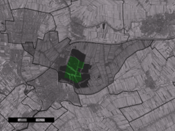
Sluipwijk
| Sluipwijk | |
|---|---|
| Village | |
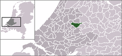 | |
 Sluipwijk in the municipality of Reeuwijk. | |
| Coordinates: 52°02′19″N 4°44′31″E / 52.03861°N 4.74194°ECoordinates: 52°02′19″N 4°44′31″E / 52.03861°N 4.74194°E | |
| Country | Netherlands |
| Province | South Holland |
| Municipality | Bodegraven-Reeuwijk |
| Population (2007) | |
| • Total | 360 |
| Time zone | CET (UTC+1) |
| • Summer (DST) | CEST (UTC+2) |
Sluipwijk is a village in the Dutch province of South Holland. It is a part of the former municipality of Reeuwijk, and lies about 3 km northeast of Gouda. The villages is surrounded by the lakes of the Reeuwijkse Plassen.
The statistical area "Sluipwijk", which also can include the surrounding countryside, has a population of around 380.[1]
Sluipwijk was a separate municipality until 1870, when it became part of Reeuwijk. In 1821, Wiltenburg had been added to Sluipwijk.[2]

References
- ↑ Statistics Netherlands (CBS), Statline: Kerncijfers wijken en buurten 2003-2005. As of 1 January 2005.
- ↑ Ad van der Meer and Onno Boonstra, "Repertorium van Nederlandse gemeenten", KNAW, 2006.
External links
- J. Kuyper, Gemeente Atlas van Nederland, 1865-1870, "Sluipwijk". Map of the former municipality in 1868.
This article is issued from Wikipedia - version of the 8/31/2015. The text is available under the Creative Commons Attribution/Share Alike but additional terms may apply for the media files.