South Wellesley Islands
Coordinates: 17°03′55″S 139°30′36″E / 17.065318°S 139.509888°E
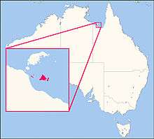
Location map of the South Wellesley Islands
The South Wellesley Islands, located South of the Wellesley Islands in the Gulf of Carpentaria, Queensland, are :
- Bentinck Island, Queensland
Where a massacre of indigenous inhabitants occurred in 1918.[1]
- Sweers Island
- Fowler Island, Queensland
- Albinia Island
- Horseshoe Island, Queensland
- Allen Island, Queensland
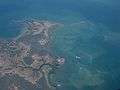 Southern part of Bentinck Island and Albinia Island
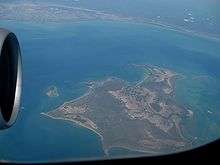 Bentinck Island with the Australian continent in the background
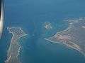 the small Fowler Island is located between Seers Island and Bentinck Island
 Location of Bentinck Island
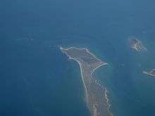 Southern part of Sweers Island
| Wikimedia Commons has media related to South Wellesley Islands. |
References
- ↑ Bruce Elder (1998). Blood on the Wattle: Massacres and maltreatment of Aboriginal Australians since 1788. Page 203 - 206: New Holland Publishers. ISBN 1-86436-410-6.
This article is issued from Wikipedia - version of the 4/11/2016. The text is available under the Creative Commons Attribution/Share Alike but additional terms may apply for the media files.