Spodnja Orlica
| Spodnja Orlica | |
|---|---|
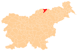
 Spodnja Orlica Location in Slovenia | |
| Coordinates: 46°33′42.09″N 15°14′58.79″E / 46.5616917°N 15.2496639°ECoordinates: 46°33′42.09″N 15°14′58.79″E / 46.5616917°N 15.2496639°E | |
| Country |
|
| Traditional region | Styria |
| Statistical region | Carinthia |
| Municipality | Radlje ob Dravi |
| Area | |
| • Total | 7.06 km2 (2.73 sq mi) |
| Elevation | 612 m (2,008 ft) |
| Population (2002) | |
| • Total | 115 |
| [1] | |
Spodnja Orlica (pronounced [ˈspoːdnja ˈoːɾlitsa]) is a dispersed settlement in the Pohorje Hills south of Vuhred in the Municipality of Radlje ob Dravi in Slovenia.[2]
History
Spodnja Orlica was established as a separate settlement in 1994, when the former village of Orlica was split into Spodnja Orlica and Zgornja Orlica (in the neighboring Municipality of Ribnica na Pohorju).[3]
References
External links
| Settlements | Administrative centre: Radlje ob Dravi
|  | ||||||
|---|---|---|---|---|---|---|---|---|
| Landmarks |
| |||||||
This article is issued from Wikipedia - version of the 7/5/2016. The text is available under the Creative Commons Attribution/Share Alike but additional terms may apply for the media files.