Spodnji Gabrnik
| Spodnji Gabrnik | |
|---|---|
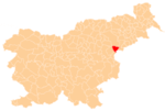
 Spodnji Gabrnik Location in Slovenia | |
| Coordinates: 46°15′54.94″N 15°34′6.05″E / 46.2652611°N 15.5683472°ECoordinates: 46°15′54.94″N 15°34′6.05″E / 46.2652611°N 15.5683472°E | |
| Country |
|
| Traditional region | Styria |
| Statistical region | Savinja |
| Municipality | Rogaška Slatina |
| Area | |
| • Total | 0.98 km2 (0.38 sq mi) |
| Elevation | 258.8 m (849.1 ft) |
| Population (2002) | |
| • Total | 118 |
| [1] | |
Spodnji Gabrnik (pronounced [ˈspoːdnji ˈɡaːbəɾnik]) is a settlement in the Municipality of Rogaška Slatina in eastern Slovenia. The entire area was traditionally part of the region of Styria. It is now included in the Savinja Statistical Region.[2]
The local church is dedicated to Saint Rosalia and belongs to the Parish of Kostrivnica. It was first mentioned in written documents dating to 1545, but the current single-nave building with a small bell tower saddling the roof at its western end was rebuilt in 1861.[3]
References
External links
| Settlements | Administrative centre: Rogaška Slatina
|  |
|---|---|---|
| Landmarks |
| |
| Notable people | ||
This article is issued from Wikipedia - version of the 7/18/2016. The text is available under the Creative Commons Attribution/Share Alike but additional terms may apply for the media files.