Stenebyen
| Stenebyen Tjelta | |
|---|---|
| Village | |
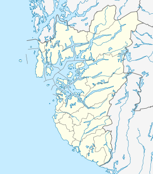 Stenebyen 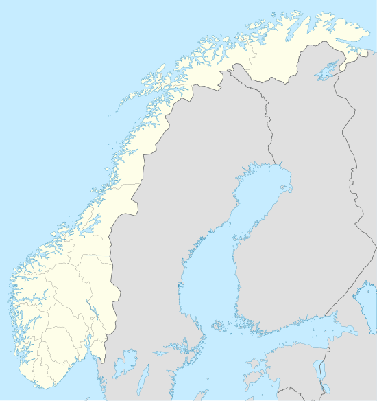 Stenebyen Location in Rogaland county | |
| Coordinates: 58°50′29″N 05°35′51″E / 58.84139°N 5.59750°ECoordinates: 58°50′29″N 05°35′51″E / 58.84139°N 5.59750°E | |
| Country | Norway |
| Region | Western Norway |
| County | Rogaland |
| District | Jæren |
| Municipality | Sola |
| Area[1] | |
| • Total | 0.4 km2 (0.2 sq mi) |
| Elevation[2] | 39 m (128 ft) |
| Population (2015)[1] | |
| • Total | 1,058 |
| • Density | 2,645/km2 (6,850/sq mi) |
| Time zone | CET (UTC+01:00) |
| • Summer (DST) | CEST (UTC+02:00) |
| Post Code | 4054 Tjelta |
Stenebyen or Tjelta is a village in Sola municipality in Rogaland county, Norway. The village is located in the south part of the municipality, about 2 kilometres (1.2 mi) southeast of the village of Hålandsmarka. The 0.4-square-kilometre (99-acre) village has a population (2015) of 1,058 which gives the village a population density of 2,645 inhabitants per square kilometre (6,850/sq mi).[1]
References
- 1 2 3 Statistisk sentralbyrå (1 January 2015). "Urban settlements. Population and area, by municipality.".
- ↑ "Tjelta, Sola (Rogaland)" (in Norwegian). yr.no. Retrieved 2016-05-21.
This article is issued from Wikipedia - version of the 8/4/2016. The text is available under the Creative Commons Attribution/Share Alike but additional terms may apply for the media files.