Swiftcurrent Mountain
| Swiftcurrent Mountain | |
|---|---|
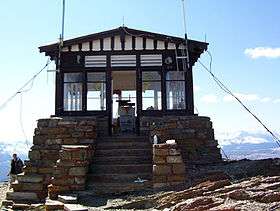 Swiftcurrent Fire Lookout at the summit of Swiftcurrent Mountain | |
| Highest point | |
| Elevation | 8,436 ft (2,571 m) [1] |
| Prominence | 676 ft (206 m) [1] |
| Coordinates | 48°47′09″N 113°46′00″W / 48.78583°N 113.76667°WCoordinates: 48°47′09″N 113°46′00″W / 48.78583°N 113.76667°W [2] |
| Geography | |
| Location | Flathead County, Montana, Glacier County, Montana, U.S. |
| Parent range | Lewis Range |
| Topo map | USGS Ahern Pass, MT |
Swiftcurrent Mountain (8,436 feet (2,571 m)) is located in the Lewis Range, Glacier National Park in the U.S. state of Montana.[1][2] Swiftcurrent Mountain is situated along the Continental Divide.[1] The historic Swiftcurrent Fire Lookout is at the top of the mountain.
See also
References
- 1 2 3 4 "Swiftcurrent Mountain, Montana". Peakbagger.com. Retrieved 2010-07-11.
- 1 2 "Swiftcurrent Mountain". Geographic Names Information System. United States Geological Survey. Retrieved 2010-07-11.
This article is issued from Wikipedia - version of the 12/23/2015. The text is available under the Creative Commons Attribution/Share Alike but additional terms may apply for the media files.