Tai Wo Station
Tai Wo 太和 | |||||||||||
|---|---|---|---|---|---|---|---|---|---|---|---|
| MTR rapid transit station | |||||||||||
 Platform 2 | |||||||||||
| Chinese name | |||||||||||
| Chinese | 太和 | ||||||||||
| |||||||||||
| General information | |||||||||||
| Location |
Po Nga Road, Tai Wo Tai Po District, Hong Kong | ||||||||||
| Coordinates | 22°27′04″N 114°09′40″E / 22.4511°N 114.1611°ECoordinates: 22°27′04″N 114°09′40″E / 22.4511°N 114.1611°E | ||||||||||
| Owned by | Kowloon–Canton Railway Corporation | ||||||||||
| Operated by | MTR Corporation | ||||||||||
| Line(s) | |||||||||||
| Platforms | 2 (2 side platforms) | ||||||||||
| Connections | Bus, public light bus | ||||||||||
| Construction | |||||||||||
| Structure type | At-grade (on embankment) | ||||||||||
| Disabled access | Yes | ||||||||||
| History | |||||||||||
| Opened |
| ||||||||||
| Services | |||||||||||
| |||||||||||
| Location | |||||||||||
|
Tai Wo Location within the MTR system | |||||||||||
Tai Wo (Chinese: 太和) is a station on Hong Kong's East Rail Line. It was opened on 9 May 1989 as an intermediate station of the East Rail Line upon the completion of the Tai Wo Estate in Tai Po New Town.
Station layout
| L4 Footbridge |
Footbridge | Exit B, Tickets/Fare Adjustment, passageway between platforms 1 and 2 |
| L2 Concourse/ Platforms | ||
| Concourse | Exit A, Tickets/Fare Adjustment, washrooms, automatic teller machines | |
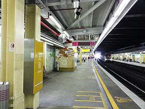
| Side platform, doors will open on the left | ||
| Platform 1 | East Rail Line towards Lo Wu or Lok Ma Chau (Fanling) → | |
| Platform 2 | ← East Rail Line towards Hung Hom (Tai Po Market) | |
| Side platform, doors will open on the left | ||
Entrances/exits
Transport interchange
Below Tai Wo Station is a transport interchange which connects residents of Tai Wo Estate to other parts of Tai Po and East and West Kowloon.
- 64K- Yuen Long (West) ↔ Tai Po Market Station
- 65K- Kadoorie Farm → Tai Po Central (Morning Peak hours)
- 71K- Tai Wo Station ↔ Tai Po Market Station
- 72- Tai Wo Station ↔ Cheung Sha Wan
- 73- Wah Ming ↔ Tai Po Industrial Estate/Tai Po Central
- 73A- Wah Ming ↔ Yu Chui Court
- 74A- Tai Wo Station ↔ Kai Yip
- 74C- Kau Lung Hang → Kwun Tong Ferry (Morning Peak hours)
- 74D- Kau Lung Hang ↔ Kwun Tong Ferry
- 271P- Kau Lung Hang → Tsim Sha Tsui (Morning Peak hours)
- 273C- Kau Lung Hang → Tsuen Wan West Station (Morning Peak hours)
- 273P- Tai Wo Station → Tsuen Wan West Station (Morning Peak hours)
- 307C- Tai Po Tau → Wan Chai (Morning Peak hours)
- 307P- Tai Po ↔ Causeway Bay (Peak hours)
- N73- Lok Ma Chau ↔ Sha Tin Central (Night route)
- Public light bus routes[2]
- 21K- Wai Tau ↺ Tai Po Market
- 25A- Tai Po Market ↺ Nam Wa Po
- 25B- Tai Po Market ↺ Kau Lung Hang / Yuen Leng
- 25K- Tai Po Market ↔ Ng Tung Chai
References
- ↑ "Tai Wo Station layout" (PDF). MTR Corporation. Retrieved 15 November 2014.
- 1 2 3 4 "Tai Wo Station street map" (PDF). MTR Corporation. Retrieved 15 November 2014.
| Wikimedia Commons has media related to Tai Wo Station. |
This article is issued from Wikipedia - version of the 11/18/2016. The text is available under the Creative Commons Attribution/Share Alike but additional terms may apply for the media files.