Tarrenz
| Tarrenz | ||
|---|---|---|
 | ||
| ||
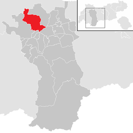
 Tarrenz Location within Austria | ||
Location in the district
| ||
| Coordinates: 47°15′50″N 10°45′45″E / 47.26389°N 10.76250°ECoordinates: 47°15′50″N 10°45′45″E / 47.26389°N 10.76250°E | ||
| Country | Austria | |
| State | Tyrol | |
| District | Imst | |
| Government | ||
| • Mayor | Rudolf Köll | |
| Area | ||
| • Total | 74.64 km2 (28.82 sq mi) | |
| Elevation | 836 m (2,743 ft) | |
| Population (1 January 2016)[1] | ||
| • Total | 2,712 | |
| • Density | 36/km2 (94/sq mi) | |
| Time zone | CET (UTC+1) | |
| • Summer (DST) | CEST (UTC+2) | |
| Postal code | 6464 | |
| Area code | 05412 | |
| Vehicle registration | IM | |
| Website | www.tarrenz.at | |

Tarrenz is a municipality in the Imst district and is located 3.60 km north of Imst at the lower course of the Gurgl brook. The village is an agriculture community with emphasis in sheep breeding and a settlement for commuters. In the last years Tarrenz was able to increase its economy and also to beautify the picture of the village. It has 2568 inhabitants.
Population
| Historical population | ||
|---|---|---|
| Year | Pop. | ±% |
| 1869 | 1,310 | — |
| 1880 | 1,205 | −8.0% |
| 1890 | 1,179 | −2.2% |
| 1900 | 1,085 | −8.0% |
| 1910 | 1,129 | +4.1% |
| 1923 | 1,173 | +3.9% |
| 1934 | 1,250 | +6.6% |
| 1939 | 1,426 | +14.1% |
| 1951 | 1,368 | −4.1% |
| 1961 | 1,577 | +15.3% |
| 1971 | 1,786 | +13.3% |
| 1981 | 1,962 | +9.9% |
| 1991 | 2,263 | +15.3% |
| 2001 | 2,537 | +12.1% |
| 2011 | 2,648 | +4.4% |
Gallery
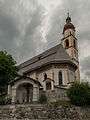 church: katholische Pfarrkirche heilige Ulrich
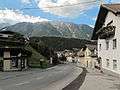 street view in Tarrenz
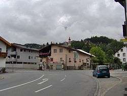
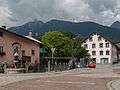 street view in Tarrenz
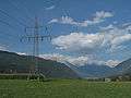 panorama between Tarrenz and Imst
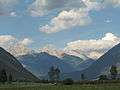 panorama between Tarrenz and Strad
References
External links
| Wikimedia Commons has media related to Tarrenz. |
This article is issued from Wikipedia - version of the 7/22/2015. The text is available under the Creative Commons Attribution/Share Alike but additional terms may apply for the media files.