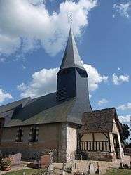
Thuit-Hébert
| Thuit-Hébert | |
|---|---|
 | |
 Thuit-Hébert | |
|
Location within Normandy region 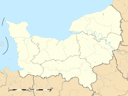 Thuit-Hébert | |
| Coordinates: 49°19′21″N 0°50′07″E / 49.3225°N 0.8353°ECoordinates: 49°19′21″N 0°50′07″E / 49.3225°N 0.8353°E | |
| Country | France |
| Region | Normandy |
| Department | Eure |
| Arrondissement | Bernay |
| Canton | Bourgtheroulde-Infreville |
| Area1 | 3.68 km2 (1.42 sq mi) |
| Population (2013)2 | 318 |
| • Density | 86/km2 (220/sq mi) |
| Time zone | CET (UTC+1) |
| • Summer (DST) | CEST (UTC+2) |
| INSEE/Postal code | 27637 / 27520 |
| Elevation | 94–141 m (308–463 ft) |
|
1 French Land Register data, which excludes lakes, ponds, glaciers > 1 km² (0.386 sq mi or 247 acres) and river estuaries. 2 Population without double counting: residents of multiple communes (e.g., students and military personnel) only counted once. | |
Thuit-Hébert is a former commune in the Eure department in Normandy in northern France.[1]
History
On 1 January 2016, Bosc-Bénard-Commin, Bourgtheroulde-Infreville and Thuit-Hébert merged becoming one commune called Grand-Bourgtheroulde.
Population
| Historical population | ||
|---|---|---|
| Year | Pop. | ±% |
| 1962 | 221 | — |
| 1968 | 234 | +5.9% |
| 1975 | 228 | −2.6% |
| 1982 | 227 | −0.4% |
| 1990 | 276 | +21.6% |
| 1999 | 310 | +12.3% |
| 2008 | 306 | −1.3% |
| 2013 | 318 | +3.9% |
See also
References
- ↑ Arrêté préfectoral 9 December 2015 (French)
| Wikimedia Commons has media related to Thuit-Hébert. |
This article is issued from Wikipedia - version of the 3/24/2016. The text is available under the Creative Commons Attribution/Share Alike but additional terms may apply for the media files.