Timburi
| Timburi | |
|---|---|
| Municipality | |
|
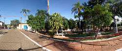
Praça principal | |
 Location in São Paulo state | |
 Timburi Location in Brazil | |
| Coordinates: 23°12′19″S 49°36′24″W / 23.20528°S 49.60667°WCoordinates: 23°12′19″S 49°36′24″W / 23.20528°S 49.60667°W | |
| Country |
|
| Region | Southeast Region |
| State | São Paulo |
| Area | |
| • Total | 197 km2 (76 sq mi) |
| Population (2015) | |
| • Total | 2,699 |
| • Density | 14/km2 (35/sq mi) |
| Time zone | BRT/BRST (UTC-3/-2) |
Timburi is a municipality in the state of São Paulo in Brazil. The population is 2,699 (2015 est.) in an area of 197 km².[1] The elevation is 838 m.
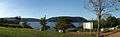 Camping do Redondo
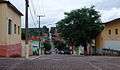 Rua do Centro
References
This article is issued from Wikipedia - version of the 5/15/2016. The text is available under the Creative Commons Attribution/Share Alike but additional terms may apply for the media files.